October 7 to 15, 2011
BJ74 reconnaissance run to Naches and Mount St. Helens
By Glenn (Glenn-BJ74)
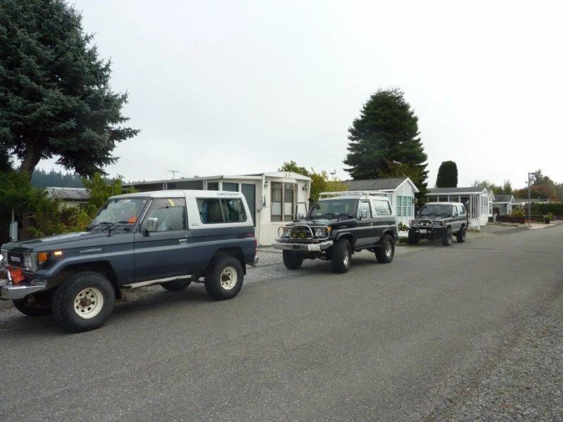
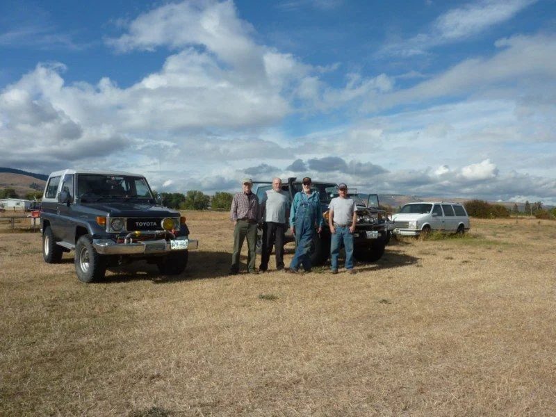
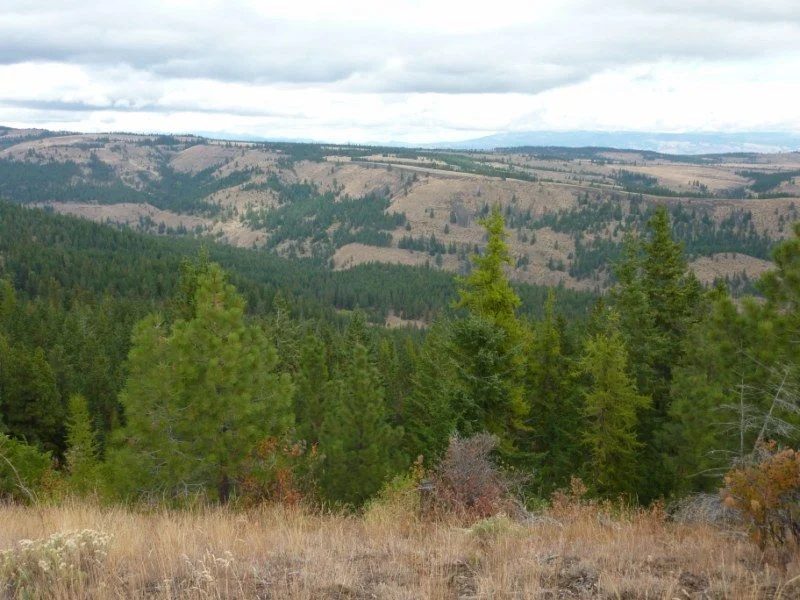
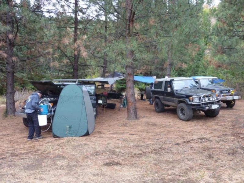
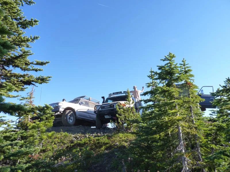
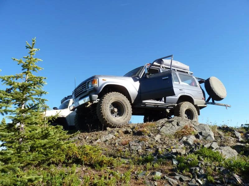
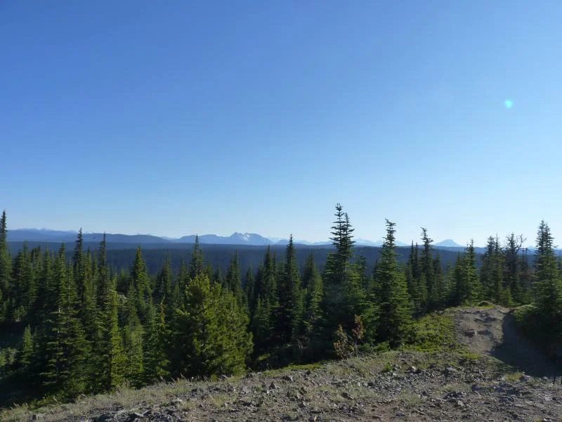
Here is a story of three BJ74s touring the Interior of Washington State, including Ellensburg, Naches, Yakima, Goldendale, Glenwood and Mt. St. Helens.
Day 1 Friday – Scramble through the Border
Well I finally got some interest in checking out some of the Naches trails in Washington State. Gary T, Bill W. and I decided to do a recon run into the Interior of Washington State looking for some dry and warm weather behind the Cascades Mountains. Our last October 2010 run through the Whipsaw was cold and wet so we were looking for better weather and new terrain to explore.
On Friday, October 7th I came over from the Island and met Gary and Bill at the truck scale just north of the truck border that night. The border line-up was surprising short for a long-weekend and Bill and I went through without incident. However, the US border guards were delaying Gary .... and Bill and I were getting worried they might not let him in. After a few anxious minutes, Gary got through and it turned out that the border guards were more interested in his rig interrogating him from the passenger’s and driver’s side windows. Once though the border we hit the Cost Cutter to load up on food, the truck stop to load up on diesel and then we went to the Birch Bay Leisure Park to crash.
Day 2 Saturday- Mike W.’s and his Cushman Collection
Saturday morning we packed our stuff and immediately drove to Harbor Freight in Bellingham to load up on cruiser crap and tools. From Harbor Freight we went to my favorite sandwich shop, Avenue Bread in Bellingham for a huge lunch, and then we continued to the Seattle Outlets, just north of Marysville. There Bill bought shoes, Gary video equipment and I bought a heavy-duty hoody for the winter. Saturday being on a holiday weekend, the place was a zoo with huge crowds of shoppers. Once through those crowds we hit the freeway again and headed south on I-5, 405 and turned east onto I-90 and through Snoqualmie Pass down the back on the Cascades to the dry Interior of Washington State.
At Ellensburg, we fuelled and bought more food before looking for the Umtanum trail. This was as a trial I had found on the Web ( Washington Trails ). While at the grocery store two locals, Mike W. and his son struck up a conversation with Gary and Bill in the parking lot about our ‘weird’ rigs. They continued yammering away and it was getting late so I urged the crew to pull stakes and head for the hills. We found Umtanum Road and after some confusion following Mike’s directions, we found ourselves on Manatash Road with Mike W. following us. We stopped to talk again and after their insistence we decided to camp in Mike’ field under the rolling golden hills of the Ellensburg Valley. After setting up camp in Mike’s 3 acre field, his son lit a roaring campfire in our honor. Mike continued to talk our ears off and we barely had time to scarf down some ‘emergency’ soup before darkness. We continued yakking until we ran out semi-truthful stories to tell and finally we hit the hay. In the morning, Mike W. gave us a tour of his magnificent collection of antique Cushman motorcycles, scooters, trikes and Honda Trail bikes. After a quick breakfast we bid farewell to hosts Mike and his son and headed out looking for adventure in whatever comes our way.
Day 3 Sunday - Monatash Ridge
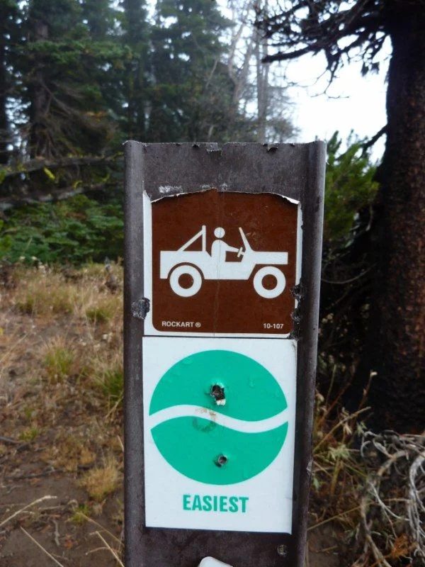
From Mike’s place we followed the Umtanum Road and into the golden hills. These hills reminded us of the Douglas Ranch area, but the area was much bigger and more open with a maze of good gravel roads going everywhere. We eventually found a junction where the roads started to deteriorated, which raised our hopes for some interesting wheeling. There we saw the ‘green dot’ signs and another very new looking sign saying that all users of state land needed the new Discovery Pass.
Beginning July 1, 2011 all users of state land in Washington State require a Discovery Pass, which is a yellow pass that hangs from the rearview mirror, visible from the front of the vehicle. Discovery Passes are included in state camping permits, hunting, and fishing and ORV licenses; but without those each vehicle needs a Discovery Pass for driving on state back roads ($35.00 per year). Apparently the Washington State has passed legislation requiring agencies administering state lands to be financially self-supporting from users. The Discover Passes are not required in National Forests. Unless we are planning to spend all of our time in National Forests, next time we come we will need to buy a Discovery Passes.
Well back to the trip. After driving up and down the scenic ridges overlooking the Ellensburg Valley we eventually found a little streamside camping spot by Wenas Creek. We set up camp, had hot steamy showers, ate a multi-course dinner and enjoyed the evening ski before retiring to our comfy warm rigs.
Day 4 Monday - Bethel Ridge Trail
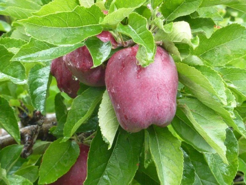
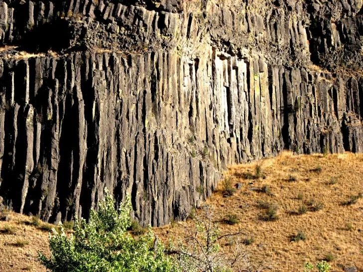
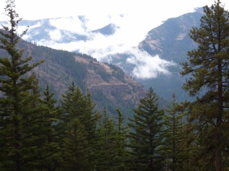
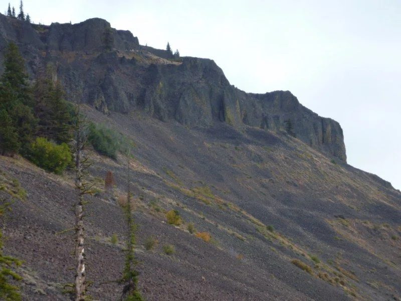
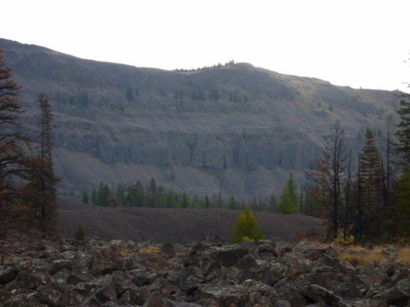
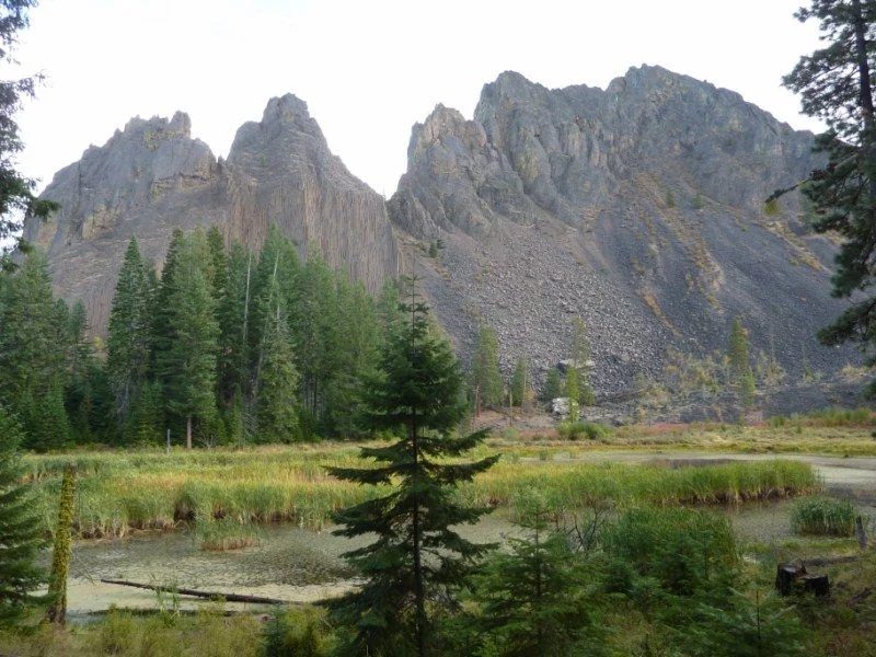
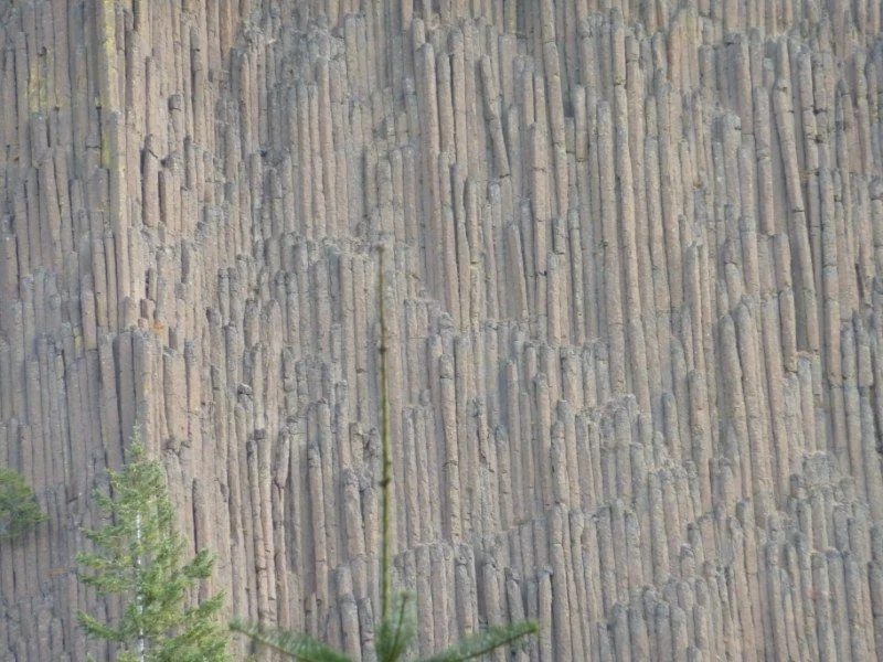
That morning we decided to go to Naches. We drove into the small town and had a look around, then crossed the bridge over the Naches River and went to the town of Tieton. We past a dozen large fruit packing plants and many semi’s loaded with fruit and corn and thousands of acres of apple trees. These were the most unusual apple trees. They were small trees, maybe 8-10’ tall, strung in rows along wires and absolutely over-loaded with apples. These trees are set up that way to make it easy for the apple pickers, which are in short supply. After our Tieton orchard tour we headed back to Naches and pulled into a bar and restaurant for lunch. After rubbing shoulder with the locals we headed west on Hwy 12 into the Wenatchee National Forest. National Forests allow ‘dispersed camping’ without permits. We followed Hwy 12 along the beautiful Tieton River which provided us with views of volcanic cliffs and basaltic columns. Eventually we arrived at the Bethel Ridge Road turn-off east of Rimrock Lake.
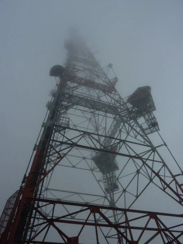
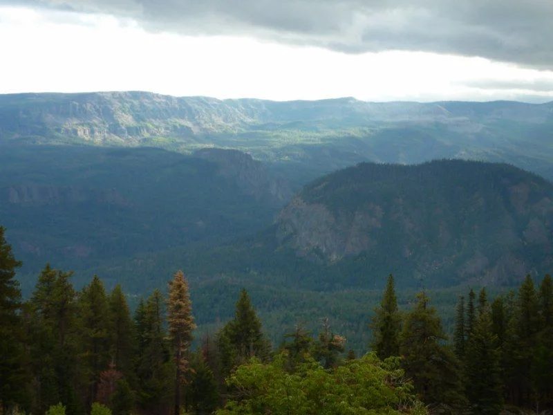
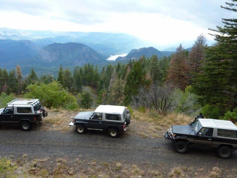
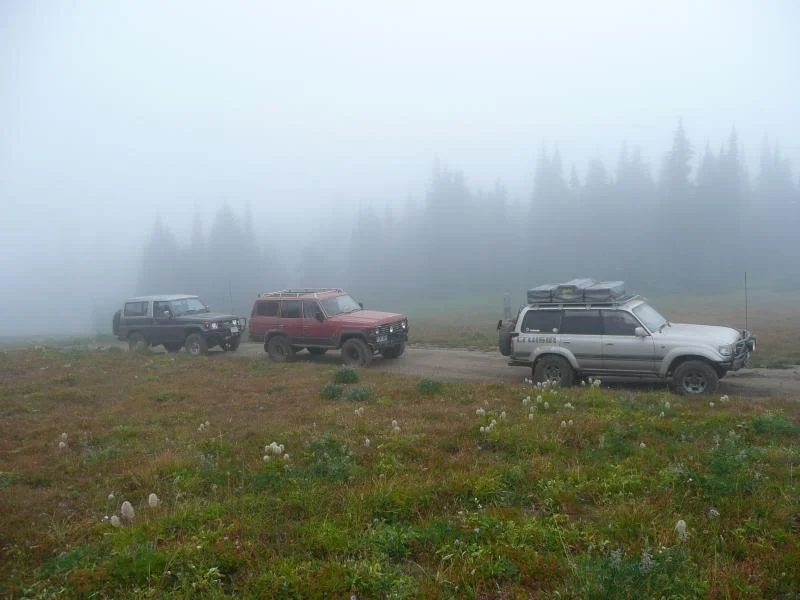
We followed the Bethel Ridge Road, headed up a high quality gravel road, although it was severely wash-boarded in places. The Bethel Ridge road climbed for a long while through several long switch backs and just before we got to the top we past two wood cutters loading 10’ logs into their overloaded F-350. Just past the wood cutters at 6,200 feet we entered clouds and our view of the magnificent Tieton Valley was obstructed by fog. At the top we found the Bethel Ridge trailhead which runs along the ridge line parallel to the valley. On a clear day the views would be incredible, but we were surrounded in cold fog. Gary and I jokingly suggested we camp on Bethel Ridge. Bill repeatedly insisted he did want to camp up here because it was cloudy and cold. We had a look at the huge microwave tower with its top not visible through the fog. On our way down from the ridge we took a road that took off from a switchback. Down that road we found great views of the valley and Rimrock Lake and several great camping spots. We concluded these sites would great base camps, which would allow us to explore the volcanic landscape area in more detail. It was getting late in the day so we continued our descent to the warmer valley and found a camping spot on a side hill hidden in the bush not far from the highway. It rained that night, but we had our tarps up.
Bethel Ridge ...
This is off the main road where a base camp would be great for hiking.
Day 5 Tuesday – Louie’s Way Trail and the Inebriated Pickers
That next morning we decided to look for Louie’s Way, another NWJeep trail which was further along Hwy 12 east of Rimrock Lake. We found the forest road turn-off and soon into the trail we discovered the rain had turned the trail into a slippery clay gumbo similar to the mud we encountered last May long weekend at Churn Creek.
We cautiously crept our way along the trail ‘slipping and sliding’ on the hills and we eventually got to fantastic viewpoint just past some 4’ mud holes. All locked up I got through two of these mud holes, but I knew that Bill’s AT tires and lack of lift he would not make it through. This turned out to a wise decision because the mud holes got deeper. Gary and I walked in several kilometers and concluded that only a high-horsepower rig on 44’s would have a chance to power through these 6’ to 7’ mud holes. Although this trail was rated as ‘easy’ a few years, due to extensive damage caused by irresponsible wheelers, the trail is ‘most difficult’.
Day 5 Tuesday – Louie’s Way Trail and the Inebriated Pickers
It looks like Louie's Way goes around that volcanic outcropping
Rimrock Lake
After a look at Louie’s Way we drove around Rimrock Lake, which we did in sunshine which just broke through the clouds when we arrived at the lake. Rimrock Lake is a gem, with many campsite and dozens of intriguing trails heading south into the Goat Rock Wilderness Area.
I would expect Rimrock Lake to be crowded in summer, as it is easily accessible and has a large capacity to accommodate campers. We all agreed this would be an ideal area to explore in warmer weather and being in a National Forest ‘dispersed camping’ is permitted. Just before leaving the Rimrock Lake we aired up and drove along Hwy 12 decided back to the Yakima to dry out for a day or two.
Inebriated Pickers
Yakima is near the Yakima Training Center, which is live-fire US army anti-aircraft artillery range. Yakima is also near the US Department of Energy’s decommissioned Hanford Nuclear Site, which produced plutonium for the first atomic bomb detonated at the Trinity Site as part of the Manhattan Project. We arrived in Yakima late in the day so we were forced to stay nearby and the only place we could find was the Yakima Sportsman State Campground, located by the Yakima River in what Gary called an oasis in the desert.
We camped by two iterant apple pickers, who were ‘whooping it up’ around a roaring campfire surrounded with 2 to 3 dozen empty beer cans. Both pickers were fully inebriated and warned us to be on the lookout for a marauding cat, who stole their 15 lb. chicken (they don’t make’em that big). They also warned us about the skunks that come out from the bush at night. We first thought this was a big mistake and we would kept awake all night long, from the hooting and hollering, but we had little alternative with darkness approaching. Well to our amazement the goofy pickers went to bed at 9:00 pm, the cat came out to steal their dinner scrapes (which we speculated happens every night) and later the skunk came out to see what was left over.
What a weird experience that was!
Day 6 Thursday – Klickitat River
As they said the apple pickers left at 5:00 am without any noise leaving the messiest camping site I have seen. After breakfast we left the Sportsman State campground and headed south to extend our dry weather tour. We entered the huge Yakima Indian Reserve and fueled up at Toppinish ($1.00 USD per litre) and then drove southwest on Hwy 97 which is designated as a ‘scenic byway’. Just north of the rural town of Goldendale we found the Brooks Memorial State Campground. There we had hot shower (for 50¢), lunch and took pictures of some Bluebirds.
Feeling clean and with full stomachs we turned west on Hwy 142 into Goldendale. There we passed a Dairy Queen, which Bill can’t do – so we had to stop for ice cream sundaes. Gary spent a few anxious minutes investigating a possible rad hose leak, which we fixed. We drove through the pleasant little town of Goldendale and along Hwy 142 and took the Glenwood turn off. This was a stroke of luck as this road descended into an incredibly little canyon, in the bottom of which flowed the Klickitat River.
My US topo maps indicated a faint turn-off on the left at the bottom of the canyon, which we took. Just before approaching what we thought was the camping area we turned down a little wiggly road, which dead ended at a fishing hole. After about 20 minutes we were visited by a Tacoma pick-up and Bill was predicting doom and gloom that we would be told to leave. We were on state land so we actually needed the Discovery Pass, which we did not have. It turned to be a friendly fisherman, nursing a bud lite with his wife who wanted to us check out our camp. They were astounded that we had driven this far and we were not fisherman! Relieved that we could stay the night at this incredible spot - we decided to celebrate by cooking up a gigantic pot of delicious spaghetti. We ate dinner around our aluminum dining table and talked about the day’s events and admired the bright starry night sky with the Klickitat River rippling not far away.
Day 7 Thursday – Mount Helens Volcanic Monument
From the Klickitat River we packed up early to avoid detection and drove into the little rural town of Glenwood. Gary who is usually last up did not get breakfast that morning because of our stealthy departure so he suggested we have a bite to eat. We found the only restaurant in town with a “Home Cooking” sign out front. I had two eggs, a large pile of fried potatoes and a plate sized pancake, which I could not finish for $4.95.
Glenwood is in 1950’s time wrap complete with old cars (e.g. 1950 Kaiser Ambassodor) and gas station that said 20¢ per gallon on their busted gas pumps. As we drove around Glendale the locals were pulling back there curtains and gawking out their windows looking at our weird little Toyota Landcruisers idling through town.
I suggested we leave before the local Sherriff gets in on the action and so we took off for Trout Lake to find the Mt Adams Ranger Station at Trout Lake to get information on Mt. St. Helens.
Mt. St. Helens
We found the Ranger Station in Trout Lake and once inside we found two Rangers, both decked out in impressive National Forest Service uniforms. Within a minute of one Ranger telling us the best place to view Mt. St Helens, the other stood up and contradicted him and told us to take FS 88 and go the Windy Point turn-off. After thanking the two we backed out of the building. The information we got from the ranger Station confirmed that best view of the blown out crater would be from the East side rather than the more popular west side access from I-5
We followed FS 88, which was a narrow twisty, but paved road that wound its way through the dense park-like forest. We were able catch glimpses of the imposing Mt Adams (12,276’), which is located directly to the east of Mount St. Helens, and area is deserving of further exploration. After a few hours we got to the Windy Point turn-off which winds its way through the mountains and soon we began to notice thousands of bare standing trees, evidence that we had entered the volcanic blast zone. We saw Sprit Lake, which is still full of thousands of floating logs left over from the volcanic blast that occurred 31 years ago. We arrived at the cold Windy Ridge viewpoint we could clearly see the mile-wide crater on the back side of the volcano.
Mt.St. Helens
The picture below is the "before" picture.The second picture is during the eruption.
Mt. St. Helens erupted on May 18, 1980, which was the most destructive volcanic event in US history. The blast killed 57 people, destroyed 250 homes, 47 bridges, 15 miles of railways, and 185 miles of highway. The eruption measured 5.1 on the Richter scale and reduced Mt. St. Helen’s mountain peak by 1,300 feet and left a 1 mile wide horseshoe-shaped crater you can see it the picture. Since then the Mount St. Helens National Volcanic Monument was created to preserve the volcano’s blast area for scientifically study.
Pumice Pickers and Spirit Lake
more pics
Day 7 Thursday -cont'd
After that we were anxious to drop elevation to warm up and find a camp site as we were burning up our last daylight. We had to stay within the National Forest and drove around a maze of forest roads in dense wet forest for about an hour looking for a half-decent camp site without success. In desperation we drove south back to Trout Lake and turned up a forest road that had a sign saying Layser Cave.
We climbed steadily up a secondary forest road and came to a sloped pull-off that was barely useable for a camp spot. Bill and Gary scouted farther up the road without any luck so we decided to stay near the cave. At least it was dry and fairly warm.
After a quick dinner Gary and I decided to do night hike down to the cave which was perfect for a dark October evening approaching Halloween. In the Cave we took pictures and speculated what the cave was used for by the native Indians. After that we crawled into our rigs and after good sleep we packed our rigs and headed north to air up before we hit the I-5.
The last picture looks like limestone holding the rock fragments together in the cave's roof..
Day 8 Home Sweet Home
Our next stop was Cabelas located in Lacey, WA. Well if you like outdoors gear - Cabelas has it all. There we had lunch and shopped for a few hours. After that the plan was to stay at Birch Bay, Friday night and go through the border Saturday morning. Camping close to home that night it hit -3C that night, the coldest night we had the entire trip. Saturday morning we packed up for the last time and parted ways before heading though the Canadian border .
This trip turned out to a memorable one that gave us a sampling of Washington State’s deserts, volcanic mountain scenery and rural American culture, calling out to us ‘you all come back now’ - we will return to the Naches and Rimrock Lake areas when it is warmer
The thread on IH8MUD
September 12 to 17, 2011
Lillooet and Relay Creek
By Glenn (Glenn-BJ74)
Bill and I were wheeling last week - here is my version of the story...
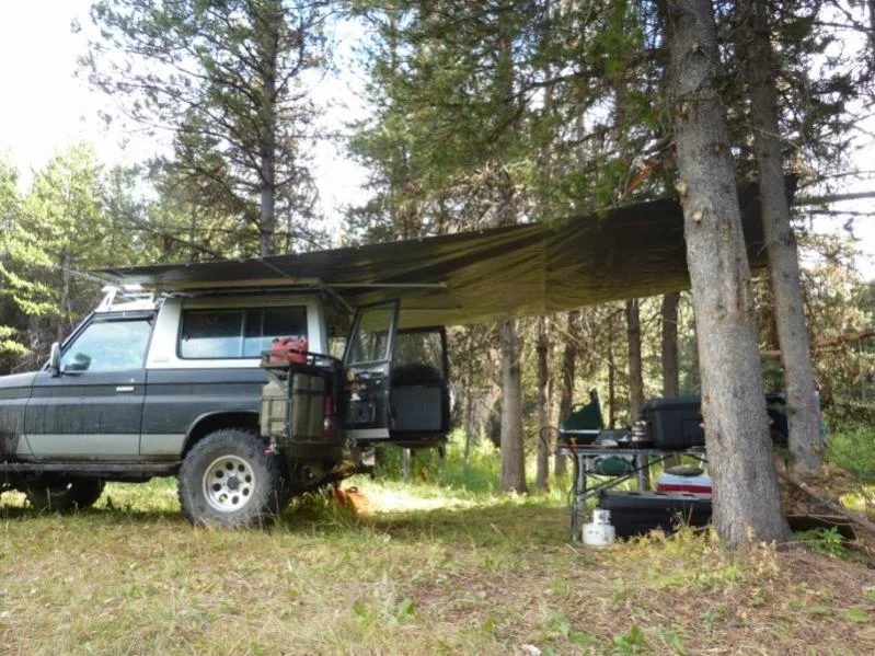
Day 1 Monday- Hale to the Big Structure Well Bill W. and I decided to head for an Indian summer wheeling trip to take advantage of the warm weather we have been enjoying this September. I had to finish painting my house over the weekend so we headed out on a bright Monday morning. Coming from the Island I had to hit Blaine first to pick up some Cruiser crap (PTO u-joints) and a heavy duty silver 10’ by 18’ hay tarp I ordered to fit my new aluminum roof rack I had made by a marine fabricator on Vancouver Island. After the wet Chilcotin trip last July, I decided to get a roof rack and an easy to deploy canopy system to keep the sides and back of my rig dry.
After picking up the cruiser booty I crossed back into Canada at the Aldergrove crossing and headed to the Tim Horton’s in Mission to meet Bill at noon for lunch. The plan was to head up Harrison West FSR and see the Hale Creek shelter project that was constructed the previous weekend. Just a few kilometers before the Hale Creek turnoff we heard the faint but familiar banter from Matt and Robert who had spent the weekend at Hale Creek. After avoiding a head collision with Matt (this has scarred us before) we stopped and exchanged greetings. We then parted company and headed to the turnoff and down the descending trail to the beach.
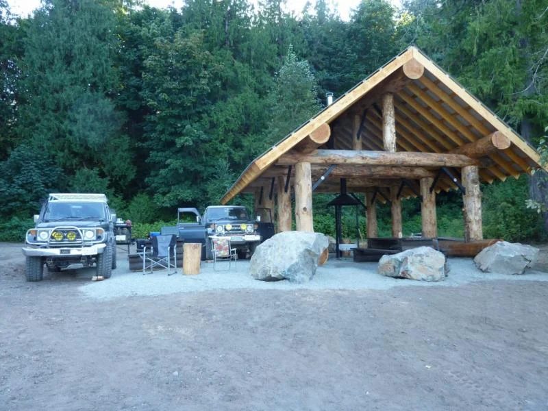
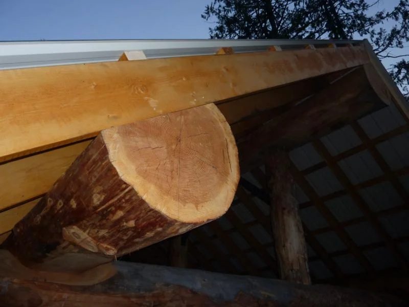
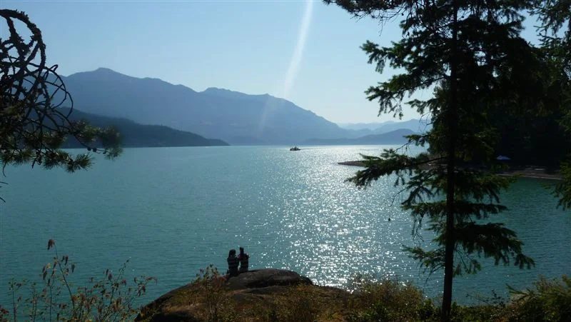
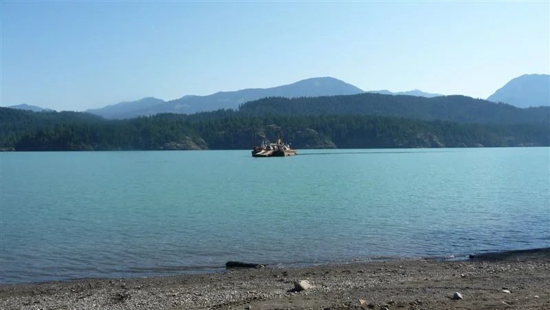
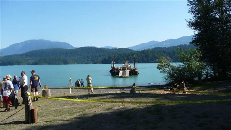
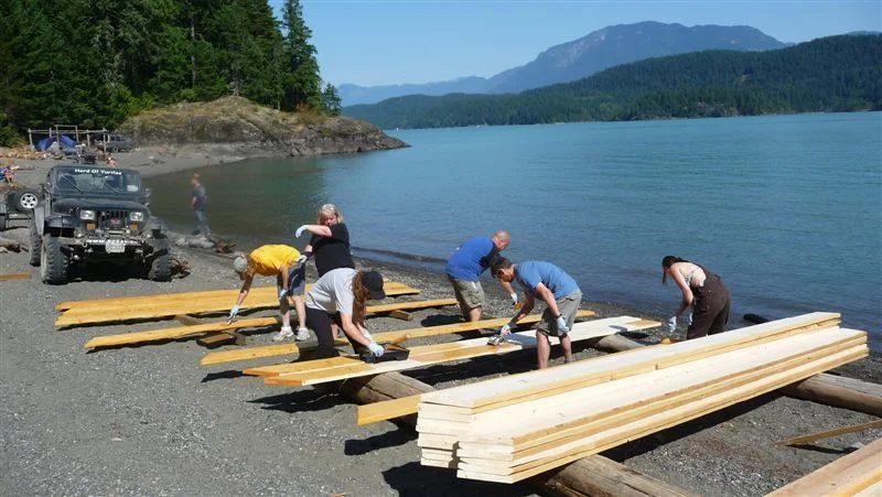
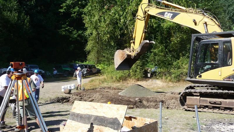
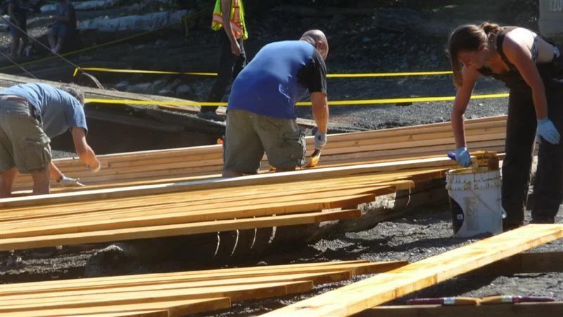
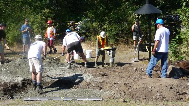
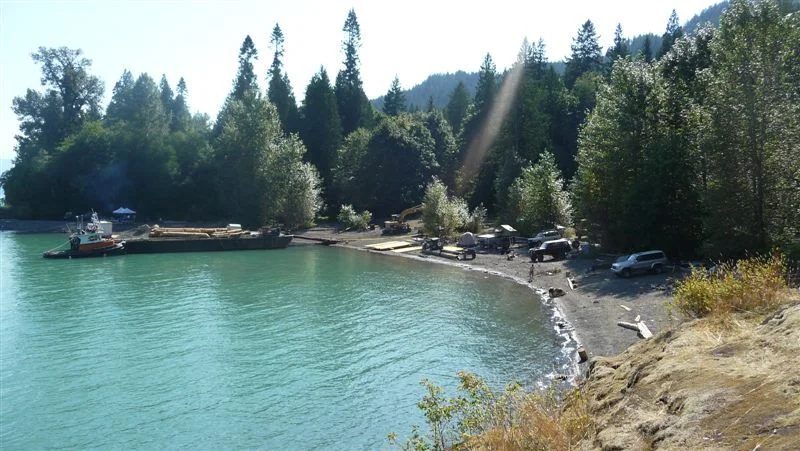
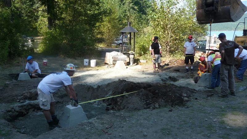
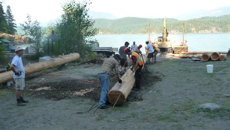
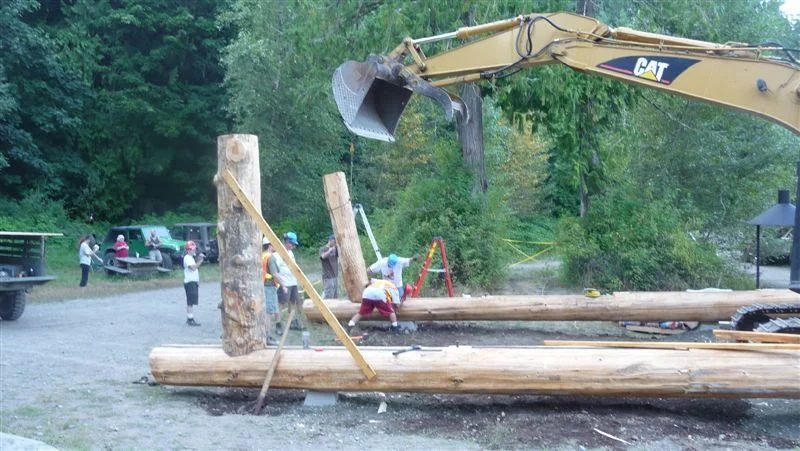
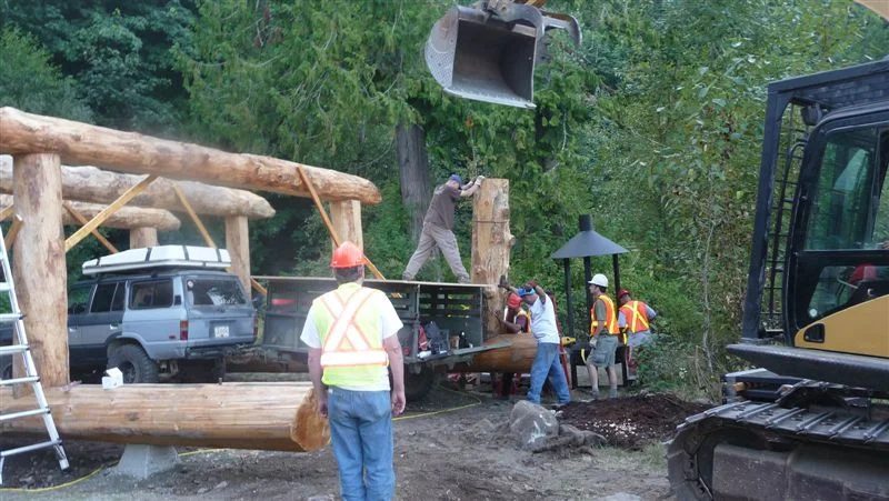
We arrived at the shelter about 3:00 pm and met Kim and his famdamly and Brent and his daughter. They were packing up Kim’s military trailer and cleaning up after the weekend construction flurry. As you can see the shelter is built like a cruiser – with a strong robust frame constructed of huge timbers--
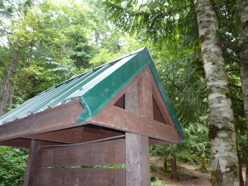
P.S. The excavator operator stopped by in his boat to show off the shelter to a couple of guys from Norway. He thought that the exposed roof edge could be lifted by heavy wind which comes off the lake in winter. The third picture is a metal roof edge flashing that is available that might prevent the wind lifting the exposed outer roof edge.
Bill and I were to take the honor of being the first post-construction campers at the new shelter. In the morning we did some brushing around the outhouse (once we found it hidden in the bush) and the surrounding signs, and we erected a Mickey Mouse sign to the outhouse. I also cut off some of the sharp branch stubs from the timbers, which I though could be safety hazard to small children and partially and fully inebriated campers.
Day 2 Tuesday- Glacier Lake
After a great sleep and hearty breakfast we pushed north up the Harrison West. The Harrison West is a dynamic road, subject to slides and periodic closures and is always different every time I drive it. The road was in good condition with some 20 percent grades and narrow sections. By now the congestion and stress of the Lower Mainland was receding as we concentrated on driving and snatching glimpses of the lake’s edge and mountain peaks as the road snaked its way along the lake’s edge. At the top of the lake we stopped at the dry land sort to have a quick lunch. The buildings and bunkhouses were all abandoned, with doors wide open offering a great invitation to vermin and vandals. This is first time I have seen it unoccupied. From the log sort we headed to Sloquet Creek Hot springs to take a gander. Although I have been up and down the Harrison West and In-Shuck-ch FSRs many times, before I have never stopped at the Sloquet Hotsprings. After a few chats to some Californian tourists and a single dirt bike rider we left.
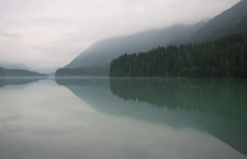
From there we proceeded north on the Lillooet West FSR up the west side of the river to check out Glacier Lake. Once we found the unmarked turn-off, we headed west up the Snowcap drainage over a thousand cross-ditches finally arriving at Glacier Lake. Glacier Lake borders Tweedsmuir Park and is part of native land claims for the In-Shuck-ch.
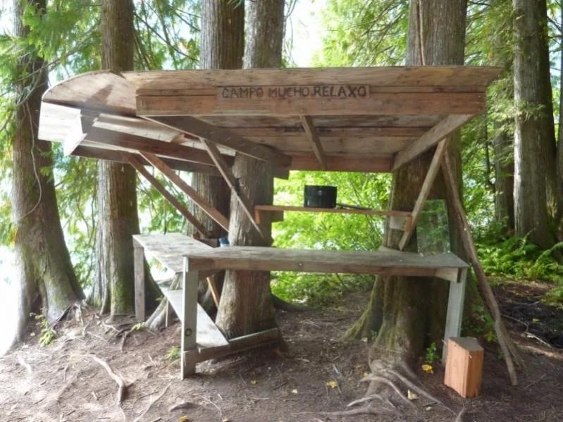
We were looking for another ‘invisible’ Backroads’s campsite which was suppose to be located mid length on the lake but we ran out of trail near the west end of the lake. We turned around and at the extreme east end of Glacier Lake we found a little shady site called -- ‘Campo Mucho Relaxo’. There we spent the night among the tall timbers with a fantastic view up the remote glacial-green lake. During the early evening I heard a moaning sound, which I initially thought be a small animal in distress. The sound was coming back along the trail we had come in on. Upon investigation I found it was a tree that was leaning on another, which must have been an internal creak within its stem that was creating a moaning sound as the wind moved it to and fro. This was a very eerily sound - perfect for scaring little children (and some more grown up).
We hit the sack at about 10:00 pm and I was awoken about 2:00 am by Bill pacing around his truck and opening and closing his doors. I found out latter a mouse had invaded Bill’s rig and was under his dashboard and I am sure Bill was imagining the little rodent chewing up his wiring and hiding his nut stash for the winter in the heater vents. Bill said he will leave that story for another time.
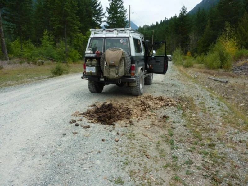
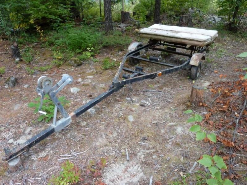
Cruiser Crap
A picture of some Crusier Crap and a budget minded trailer and RTT bed set-up we saw along the way.
Day 3 Wednesday- Old Acquaintances on Anderson Lake
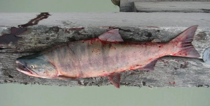
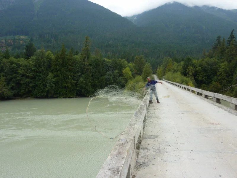
The following morning we packed up and headed back to the Lillooet West FSR and turned north past the In-Shuck-ch community of Batiste Smith and north to the Tenas Bridge to cross over to the east side of the Lillooet River. On the Tenas Bridge we saw a drift net fisherman and of course we had to stop and to talk to him. Tim was his name and he was fishing for sockeye. Well it was not long before he insisted we have a sockeye for dinner.
Day 3 Wednesday- Old Acquaintances on Anderson Lake..
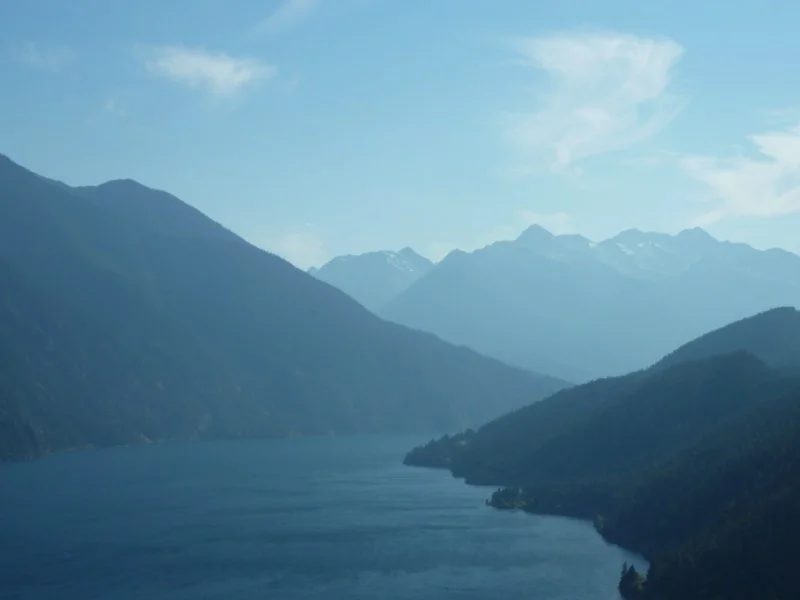
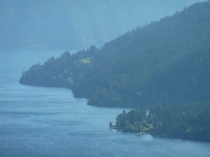
We left Tim and than continued north past Lillooet Lake Estates and had lunch at the Driftwood Bay Rec site. After a quick bite we went to Mt Currie for a diesel stop. At the gas station we chatted up the locals and had a coffee before heading to D’Arcy. In D’Arcy we stopped for ice cream, talked to the Pepsi delivery man then headed up the picturesque Highline Road. The Highline road is one of my favorite roads which runs along the high bluffs of the north side of Anderson Lake – it has awesome views I never get tired of.
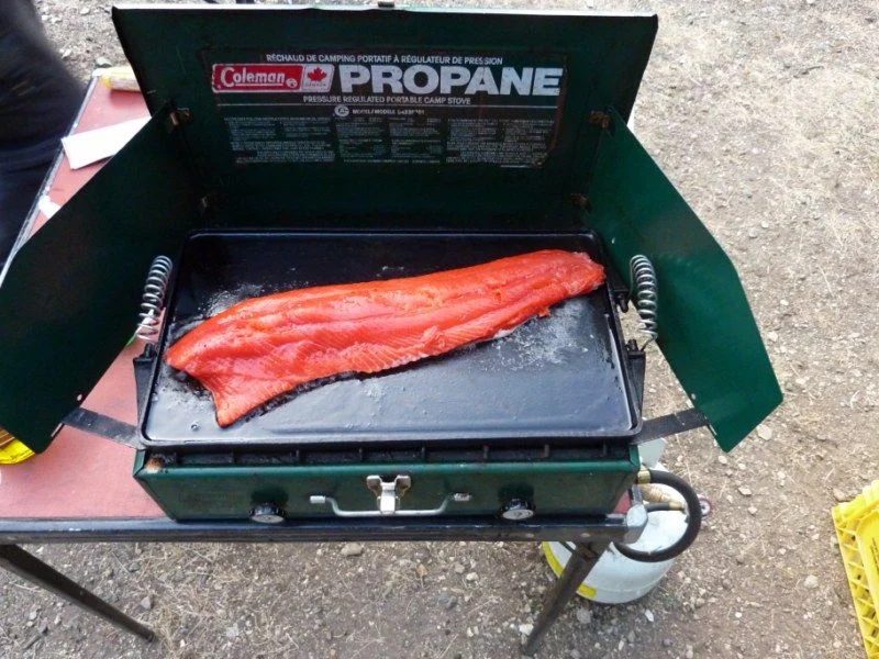
Just past McGillivray Creek we stopped to talk to a couple in a Tundra who were stopped by the roadside watering some sunflowers at the entrance to their property. After a minute or two Bill realized they were long ago acquaintances. We chatted for a while, all the time hoping they would invite us down to their place -- but that did not happen. After that encounter we continued to Seton Portage and over the mountain to Carpenter Lake and around the east end and along the north shore of the lake. It was getting late in the day and we wanted to find a campsite. To our disappointment we found many more Backroad’s campsites on the north side of Carpenter lake that do not exist. Eventually we went up Marshall Lake Road and camped at a little gem of lake called Carol Lake, which was easy and wide 2WD access. That night we savored our grilled sockeye which we was caught just a few hours earlier. With a camp fire ban we had to cook it on Bill’s grill.
Day 4 Thursday- Relay Creek Hunters
From Carol Lake we continued up the Marshall Lake road, past Marshall Lake to the Mud Paradise FSR past the Tyaughton Rec Site and on a circuitous route to the Relay Creek FSR. I don’t remember the convoluted trail system to get to Relay Creek, but I faithfully followed the GPS track from last year and found our previous camp site between two creeks. We arrived fairly early so we decided to head up the Relay Creek FSR to the end near the South Chilcotin Provincial Park. At the top of a climb we got to little drilling core camp and bumped into a 5 or 6 hunters and struck up a conversation with a couple of them. One of them had a HDJ 81 so we had lots to BS about.
Apparently they come up Relay Creek all the time to hike and hunt. During the conversation the weather was turning to rain and hail and after a while we decided to get back and set up our camp before the weather got really bad. We got back to camp and set up our rain canopies. Before dinner we deployed the on-board shower and washed away the bush grime and pulled some fresh duds. We got a nice little fire going and grilled the rest of the sockeye on the wood coals. It rained during the evening and the water on top of the canopies turned to sheets of ice by morning. It was cold and by 5:30 am it hit minus 8. I had my North Face bag inside a larger Dacron bag and I was ‘roasty toasty’ all night long. Normally that North Face bag is cold at freezing, although it’s rated to 17 below (don’t believe it). In the morning with frozen fingers warmed by the fire we packed up our rigs. The cruisers were tough to start at 5,000 feet and minus 6.
Once the rigs were warm we decided to head down to a lower level and check out the 2010 Meager Creek land slide up the Lillooet River valley.
Day 5 Friday- Capricorn Side
We headed down to Carpenter lake past the burned out Mowson Pond camp site we had stayed previously and proceeded to Gold Bridge to have lunch and call the ladies at home. Bill and I scarfed down the Gold Bridge burger before thrashing our rigs’on the unforgiving washboard of the Hurley FSR. Warning - that road is unkind to solid front axle leaf spring trucks.
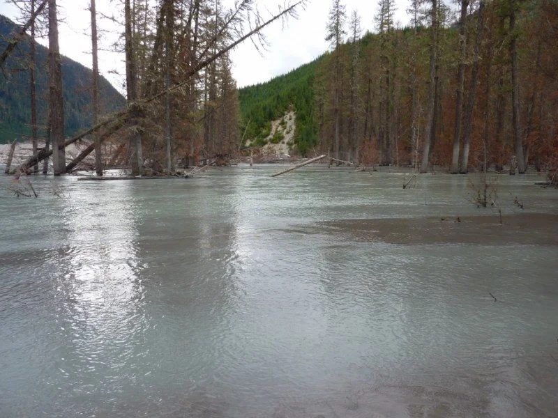
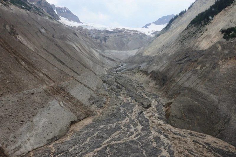
At the bottom of the Hurley, we pulled an abrupt 180 right past a several Road Closed signs (scares the tourists so the logging trucks can drive faster) and proceeded north on the Upper Lillooet FSR. On the way we encountered a logging truck, hauling out of Pebble Creek, which was in the middle of the road as I rounded a corner. That woke me up enough to pay closer attention to the road and to quit fiddling with my onboard electronic distractions. We camped at the Upper Lillooet Rec Site near the previous, Meager Springs Hot Springs turn-off, which was obliterated due a slide on August 6, 2010.The first picture shows the previous road and bridge alighment through the trees.
In 2010 there was an enormous landslide from the melting Capricorn Glacier, which was reported to transport over 40 million cubic-metres of sand, rock and debris into a 300-metre-wide, two-kilometer long wall down Capricorn Creek and into the Lillooet Valley below. By the look of it moved up the adjacent drainage then flowed downstream into the Lillooet River. The Meager Creek FSR and road access to the Meager Creek Hotsprings is gone.
At the abandoned Upper Lillooet Rec Site we picked out our site and continued up the Upper Lillooet FSR to continue our explorations of the area. We drove past the Garibaldi Pumice mine to see the waterfalls of tributaries of the Lillooet River and river itself as it flows through a narrow rock canyon. After finding a few I was met with road closures and since it was getting late I headed back to camp, to meet Bill who had left a little earlier to set up his camp. We set up out canopies, ate dinner and listened to the rain during most of the night and the roar of the Lillooet River.
Day 5 Friday- Capricorn Side
More of the Upper Lillooet Valley --mountains and several of the canyons and falls. The middle shot is downstream and bottom shot upstream.
Day 5 Friday- Capricorn Side
More shots - volcanic evidence - pumice everywhere, tributary water falls
Day 6 Saturday- Moose Encounter
We packed early in the morning and headed south on the Upper Lillooet River FSR. Along the way I had a dramatic Moose encounter - this was scarry. I was boogying down the Upper Lillooet River FSR doing about 50 ,with Bill close behind, when a Moose with a huge rack jumped out on the road, not 5 feet from my left front fender. The huge animal stumbled momentarily, regained his balance looked at me and ran down the road at full tilt. I hit the brakes, ass end coming around and when it was apparent we were not going to collide – I coasted while I watched this huge critter run for his life. Had I hit that animal, I would have probably broken his legs and badly damaged my truck. We were grateful that did not happen, because that would have spoiled an otherwise perfect September wheelin' trip.
After recovering from that incident (see picture of my cat who was with me) we proceeded down to Pemberton to air up and onto Squamish for lunch at Boston Pizza. After that I caught the Horseshoe Bay Ferry for Nanaimo and Bill went back to Vancouver.
Overall another great cruiser trip to be remembered.
The thread on IH8MUD
September 10 to 12, 2011
Hale Creek shelter build
By kim
I just got home now. I, and my family, had a decent bit of 'fun' trying to leave Hale the easy way. The truck and trailer, weighing probably in the 9000lb neighbourhood, had an issue trying to get over that large rock on the off camber section. Tried a few lines after backing down that section a little bit each time but didn't have the momentum.
So, I back all the way down the hill and do it in 2nd instead. Yee haw he says! We made the hill first shot but that shot had the trailer airborn, 3-4 FEET I'm told, I wasn't looking backwards so cant confirm it. My family, every single one were laughing like crazy, giddy like. I had to chuckle but I'll have to admit to being a 'tad' heavy. Absolutely nothing moved inside the trailer or the 3 ladders and a wheel barrow on top.
oh yeah, Bill and Glenn arrived just as we were about to leave, which was 3 or so.
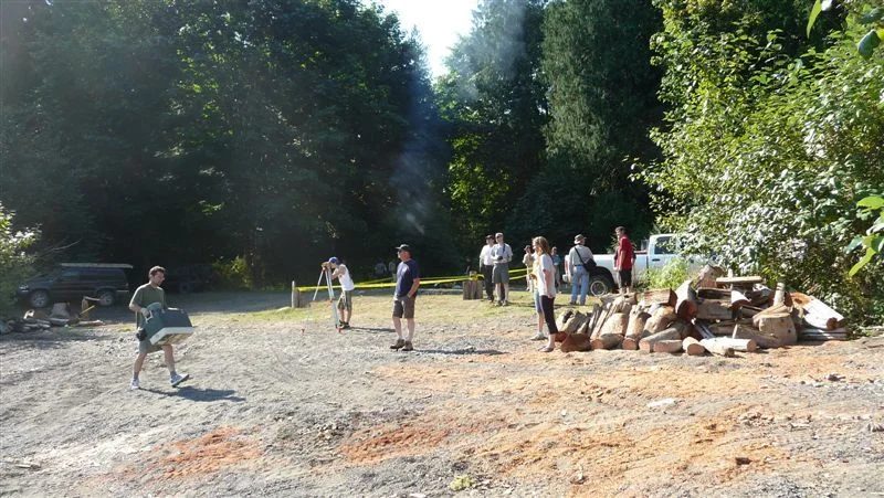
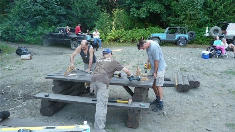
So many little things ate up time today. Dealing with site cleanup, extra lumber, metal, dunnage, pallets, the kitchen, recyclables, stains, paints, picnic tables...pack up our own camps, pack and pack some more. Mat, Robert and Brent assisted for as long as they could which stretched to 1 pm for them. Brent stayed to the end to help me with the final packing.
Exhausted is the word. So many people worked so hard to make this project probably the most amazing thing that ANY of us have done. After constructing this absolutely stunningly beautiful log structure, I find myself disbelieving that the government built this for us and we were able to actually put it up with volunteers. The sign in sheet says 45 people helped but I suspect there are those who didn't sign, maybe 10?.
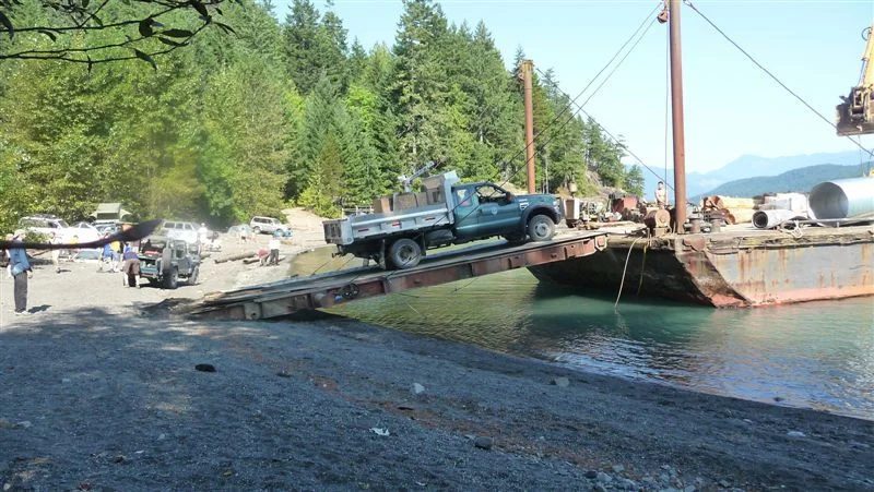
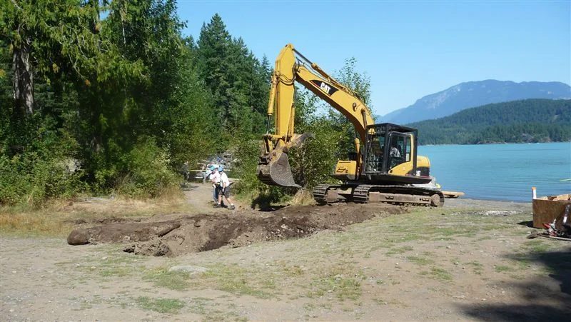
The barge arrived at about 11:30am Saturday and we worked non-stop until dark. Robert fed us gourmet food and we basically collapsed in our chairs, and eventually, bed. Sunday was a 7am start for the excavator and we were rocking and rolling until dark again, about 8:30 was when we screwed the last piece of roofing on. Robert fed us again with another wonderful meal and the bulk of the folks who were there, the log builder, Mike from the ministry, his son, Sass, and a few Association folks Corey, Rick and Kathy, Dale, and others who dont come to mind immediately.
We did it! Unbelievable!
You guys are awesome. The Cruiser club supplied quite a number of folks, basically the core of the crew, who worked very hard and maintained excellent attitudes through long hours. This wouldn't be finished without you guys!
We didn't manage to get tables to Sunrise, so we built them and left them at Hale. They burn equally as well at either altitude so we said what the hell. We didn't dig a new outhouse the current location has lots of capacity remaining it just needs to be treated with lime.
I'm going to drink now, then I'm going to bed.
Unbelievable!
Thank you to all of you. You are amazing.
The thread on IH8MUD
Early September 2011
Harrison Lake to Tulameen with zero blacktop
By John (gofast)
Hi All,
Early in September every year we do Whipsaw. This year was different though as we did it "backwards" and started at Harrison Lake. Although the title says Zero Blacktop, we did have to travel about 5 minutes of Highway 1, 10 km of the road to Brookmere, and the blacktop from Tulameen to Coalmont. The rest of it was on FSR and Trail.
Some of us stayed at Harrison Hot Springs for a big soak the night before and I think we'll end our trip there next year - absolutely fantastic!
We took the Kookipi FSR to the Nahatlach River, and then followed it down to Boston Bar, went from Boston Bar over the Uztilius FSR to Maka Creek, and then did the Murray Lake Road to the Coquihalla highway. We then went through Brookmere and the Kettle Valley Railway down to Tulameen, Coalmont.
This year's trip had potentially serious mechanical challenges, some early team drop outs and a very cold night hovering around a barbecue.
Six trucks started out and 3 finished. Sounds dramatic but it really wasn't - illness and obligation took three of us out of the trip. The report covers the section to Coalmont, others will have to finish the report.
Trucks this year were Greg's venerable 74 with custom barwok and m101 with RTT. Sheldon's diesel converted anniversary 80 with m101 trailer and RTT, Norm's 74 with barwork and bialetti, Ciaran's big 60 with swampers, tailgate kitchen and bed, Jason's 80 with a new front bar and his RTT mounted on top instead of being towed behind, and my 73 with with reworked sliders and sporting new rear side protection.
We aired down when we started down Harrison east
This was where Greg mentioned that his brakes were acting up. We agreed to continue on as he said that he'd keep an eye on it. Worst case was to trun around or go home at Boston Bar. We stopped for a quick go at boulder crawling at Silver Creek, had a quick bite and then continued on to the Kookipi.
We stopped for another break to check brakes (very hot axle stub) and see some falls
Here we found that a shoe had delaminated from the rear of Greg's 74. We removed the shoes and clamped of the rear lines and Greg decided to go out with us to Boston Bar and change shoes there if we could find them.
It didn't seem to stop him though as we travelled the Kookipi
This was my first time on the FSR and it was beautiful
The road was like driving on a coral beach, weather was high 20's and the colours were amazing.
We spent the night camped on the banks of the Nahatlatch and then made our way into Boston Bar. Greg had left early and managed to have Kal Tire order him a set of replacement shoes that would be coming from Chilliwack to th Lordco at Hope. Norm and Greg then drove down to Hope while we prepped Greg's truck and removed the wheel and drum so that we'd be ready to go when they got back. We changed the brakes in the parking lot. There was a pannel of judges assisting as well.
We left just after lunch and headed to the Uztilius FSR. Heading up this road you could really see a change in the climate. Things got dry fast and it was just as hot as the previous day. We manged to only get lost once
So we continued on and Camped at Murray lake. We then made our way to the Coquihalla the next morning. Greg and Sheldon left and the rest of us continued to Brookmere and then the Kettle Valley road to Tulameen.
I had to say good bye and carried on home using the Princeton Summerland Road
It was a drag to have missed the Whipsaw trail this year and here's a few teaser photo's.
The thread on IH8MUD
Early September 2011
Whipsaw from Tulameen to Paddy's Pond
By Jason (Cruisin')
Wednesday - Brookmere to Paddy's Pond
So, the trip took on a decidedly different flavour after the group split up. It really was a shame that not everyone was able to finish, but those of us yahoos who were left decided to make the most of it, and enjoy the rest of the trip. We carried on through Brookmere, then along the old KVR for about 10km, before joining up with the Coalmont Rd north of Otter Lake. The KVR is a beautiful chunk of road, so much so that the other guys behind me stopped for a REALLY long time to take pictures and look around. I got to the junction and waited. And waited. And waited. Couldn't summon anyone on the CB. Waited some more. Finally figured someone must have had a flat or something, so I threw it in reverse and started backing up along the road. Here's an interesting bit of trivia. In and HDJ 81 the odometer actually rolls backwards when you drive in reverse I removed almost a kilometre from my truck's milage before I found the rest of the guys wandering around and taking pictures of stuff.
We carried on to Tulameen, where we topped the coolers up with ice, and said our goodbyes to John, then carried on up the hill to Lodestone for lunch. Travelling with only 3 trucks we made really good time. Of course we stopped in the meadow for a break, and soaked up the scenery and the magnificent weather that we were still enjoying.
Doing the trail this direction we all found is easier than going in from Hwy 3, so we spent less time at the obstacles than we might have otherwise. I did a run down and back up the ledge that is above Falcon Hill,
But we mostly just pressed on. We were at Wells by around 4pm, and decided to change things up a bit and carry on to Paddy's Pond. Ciaran was thinking it was only about an hour to the pond, so that sounded like a great idea. Well, due to a small miscalculation it was quite a bit more than just one hour to Paddy's pond, but we did make it there before dark.
We set up camp and cooked dinner. It was my brother's birthday that day, so we had a feast of steak and potatoes with veggies in foil on the BBQ, followed by his favourite dessert, raisin pie (its way better than it sounds, trust me) which I had made before the trip. This was the first pie I had ever made, and it actually turned out! That evening it was really getting cold, and we were pretty sure the camp fire ban was still on, so we huddled around Ciaran's BBQ for some warmth. Pathetic. Should have grabbed Greg's propane camp fire when we split up...
Thursday - Paddy's Pond, and heading for home
Thursday morning the weather was starting to turn. It was damp and chilly feeling, and there was a bunch of cloud starting to roll over the mountains. Breakfast was a wonderful experience, heavy on the bacon and really strong coffee.
Paddy's Pond really is a nice place to spend a night, and for a small group makes a nice alternative to Wells.
We carried on down the trail, and made a stop at Richard Holding's old cabin. As it was feeling chilly we thought if you were up there and the weather really turned on you that old cabin could really make your day.
We took our time coming down the last bit of trail, not wanting the trip to be over too soon, but we were back on FSR roads all too soon.
Coming down the FSR after the trail the dust was so thick at one point I heard Norm on the CB "I've actually stopped. I can't see the road." The rain the fell in the days after we finished the trip will be welcomed by anyone who ran the trail later.
At the pavement beside HWY 3 Ciaran got out to unlock the hubs, and I hear him saying "That's weird". Then "What the... Guys, did one of you unlock my hubs earlier?" We all insisted that we hadn't (quite truthfully too!). He couldn't specifically remember locking them in, and we realized that he had just run the whole trail in 2WD Now we're thinking next year we're going to all remove our front driveshafts just to make things more interesting
This was a most enjoyable trip, and the three that had to bow out were missed on the last 2 days. We're all looking forward to next year already. Its always interesting to see how the trail changes from year to year, and its fun to see everyones truck evolve each year too, as new mods are added, and more stuff gets added to the "I really need one of those" list.
Thanks John, Ciaran, Sheldon and Chase, Greg, Norm and Daryl for a great time.
The thread on IH8MUD
Weekend of August 19, 2011
Whipsaw and a broken axle near Lodestone Lake
By Jeff (Enigma)
Well I'm back, but the Island boys still have several hours of entertainment ahead of them......
This guided your of the famed Whipsaw Trail consisted of Jason "'Cruisin" H. and family in their HDJ81 with M101 trailer, Pete "Antarctican" the FJC and trailer, Paul and family in their Tacoma, Glen in his BJ74, Andrew and buddy Greg in an HDJ81, Cam "slowandsteady BJ" in his big BJ60, and yours truly in another HDJ81.
We entered Whipsaw via a new route to me, up the Coquihalla and through Brookmere, following a part of the Kettle Valley Railway, and then towards Otter Lake/Tulameen and into Coalmont. It was a nice drive, easy gravel travel, but some nice scenery.
Once we got into Lodestone Lake, Pete and Jason had a race deploying their trailer tents. Jason won the race, but Pete took the prize for largest tent, it's freaking huge, and he only set half of it up.
Once camp was set up, the Whipsaw newbies (Pete, Andrew, and Cam) wanted to to see the old ranger station/viewpoint so up we went. We spent some time up there enjoying the view and general chit chat/tall tales, when Andrew spotted a hill to climb in the area just below. As we watched from above, Cam decided to try the hill, so we all drove down to check it out.
And that was the end of our Whipsaw trip, as Cam promptly blew the right side rear axle going up the hill.
Luckily, anyone with Telus has full cell coverage at that spot, and after several calls we were able to contact Steve and Mat and started sourcing parts for the repair. We made a log skid and strapped it under the defunct rear axle, and attempted to drag the crippled 60 back to Lodestone, but after we got it turned around it was soon apparent that the other side of the rear axle was broken as well.......
Out came the chainsaw again and another skid was made and strapped in place. I think with the one skid it may have been doable, but the behemoth did not really want to move on two skids. So we left the truck for the night and headed back to camp.
As we sat around our camp light (full fire ban in effect) we came up with a few ideas, such as finding a UHAUL dolly in Princeton and towing the truck out and then repairing it. The final choice was to head back to civilization and gather the needed parts to field repair it. As I had to leave anyways, Andrew followed me back to the city where Matt had gathered up all the required ingredients. A big thanks to Matt and Steve for their efforts, it's good to have great people like this behind us.
We hooked up with Matt in Maple Ridge, and Andrew and Greg headed back the four hour trip with the parts.
This is where my story ends, to be continued by the Island Boys.
Lot's of fish jumping in the lake. Some other people there told us the ice had just come off only 3 weeks ago.
What a view.....'nuthin but Toyota's to see.
and now what you've all been waiting for...the Carnage!
The log skid attachment. Patent pending.
Andrew just called, and they are ready to roll! They are in such good spirits that they plan on finishing the trail even.
The thread on IH8MUD